to the Friends of the St. Croix Headwaters, a community-service organization
 How do we help our community?
We help people understand that they can make a difference in their community, and can improve the quality of their lives and the vitality of our area.
We appreciate the economic importance of conservation and public stewardship of our natural resources.
 Who do we help?
Fellow citizens (at the grass-roots level) interested in community revitalization and youth education in northwestern Wisconsin.
What are our services?
We provide a forum to get people together to complete projects to improve community vitality, yet honor local history and traditions.
 What is our track record?
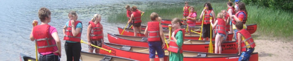
Successful efforts such as our Canoes on Wheels program that provides the use of canoe equipment at no-cost to local schools and youth groups, and our Eco Adventure project that provides outdoor education lesson modules for middle-school teachers as well as river paddling and camping experiences for students.
 Our plans for the future
To continue to promote local initiatives to improve the vitality of our communities, and our understanding of our wonderful water resources.
How do we use our money?
To support our volunteer efforts to help people understand what can be done when we are all working together.
Why do we deserve your support?
Your support will be the seed money that lets us develop and nurture locally defined projects such as our support for local schools and youth organizations. We are a 501(c)(3) nonprofit organization and all donations are tax-deductible.